10 Incredible Short Thru-Hikes
It takes time, planning, money and dedication to undertake an epic thru-hike like the Great Western Loop, Appalachian Trail or Pacific Crest Trail. If you’re looking for something more manageable—even one done in a day or two—North America has plenty of options for short thru-hikes that can be completed in a single long day if you’re an experienced trekker, or easily expanded if you’re newer to hiking or just want extra time to soak up the experience.
Whether your goal is peak-bagging, beach camping, covering diverse terrain, hut stays or just a little solitude, the following short thru-hikes (and a couple of irresistible loops) will inspire you to plan your next big-day objective or leisurely multi-day adventure.
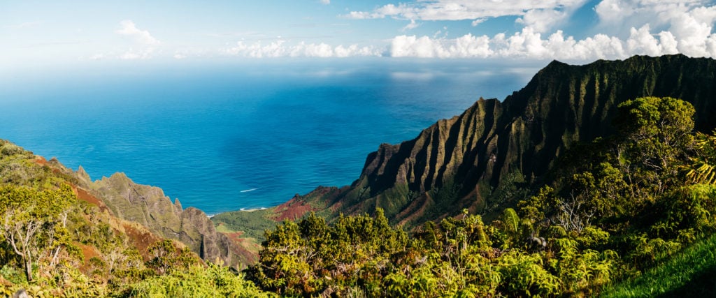
Kalalau Trail, Kauai, Hawaii
Hawaii’s most famous trail is on Kauai’s North Shore, along the dramatic—and otherwise inaccessible by foot—Na Pali Coast. While “Crawler’s Ledge” no longer lives up to its moniker due to trail improvements, it’s still a strenuous hike due to heat, humidity, unpredictable weather and 800-foot drops off the narrow path. You’ll be justly rewarded when you reach the mile-long swath white sand beach, but the non-stop views along the hike are just as compelling.
While easily covered in a day if you’re an experienced thru-hiker, part of the experience is primitive camping at Hanakoa (the only other designated campsite besides Kalalau Beach) at Mile 6. Hanakoa is also a short hike from a glorious swimming hole and waterfall. There are no latrines at the campsite, so don’t forget a shovel; Kalalau Beach has no facilities other than composting toilets).
Distance: 11 miles (one-way)
Best time to hike: May-October
Know before you go:
- You can get your camping permits (required even if you’re doing out and back—but why would you?) up to 90 days out.
- There’s an ample fresh water supply at Hanakoa Falls and Kalalau Beach, but you’ll need a purifier as well as a filter, due to the region’s feral goat population, which harbor leptospirosis (a bacteria too small for traditional filters to catch). For the same reason, be sure to disinfect and treat any cuts or scrapes.
- Note that even in summer, swimming off any of the beaches along the Kalalau Trail should be undertaken with extreme caution due to powerful riptides. Incidents of assault and theft have, unfortunately, occurred along the trail and at Kalalau Beach. If you’re a female hiking solo, do exercise caution.
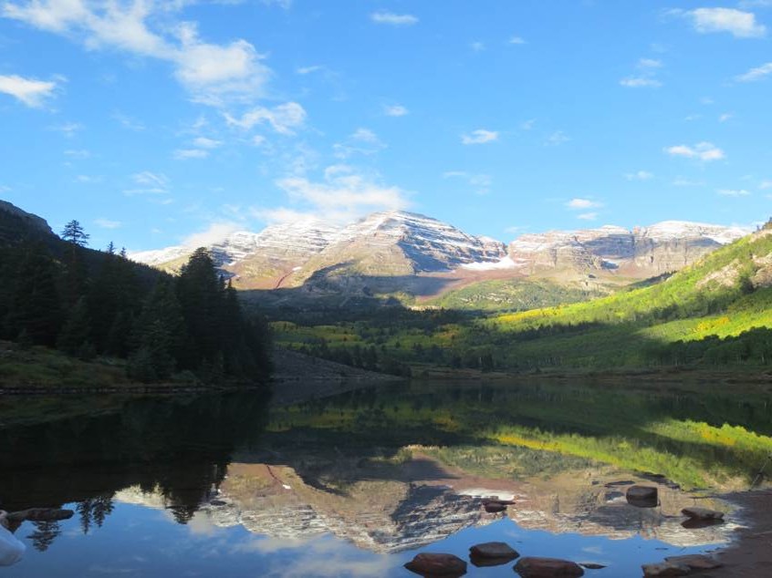
West Maroon Trail, Colorado
The 12-mile trail through the Maroon Bells-Snowmass Wilderness is beloved by Coloradans during the July wildflower bloom, but it’s also an unforgettable way to hike from Aspen to Crested Butte or vice-versa. It’s no less stunning—and far less populated—in fall, when the aspens turn and the peaks are dusted with snow; you’ll also pass through alpine tundra, streams (hiking poles recommended) conifer forest, and meadows dotted with the ruins of 19th century homesteads. West Maroon is also popular with ultra-runners as an out and back.
Distance: 11 miles (point-to-point)
Best time to hike: Mid-June through early October. Regardless of timing, be prepared for inclement weather, summer means afternoon thunderstorms and extreme lightning risk.
Know before you go:
- The more popular route is to start in Aspen, where you can catch the sunrise over Maroon Lake and the famous Bells (and avoid the crowds), but this direction also means a quad-torching 1,000 foot, one-mile ascent to the summit of 12,500-foot West Maroon Pass. The Forest Service requires a permit if you plan to camp.
- West Maroon can be a logistical challenge if you’re not doing the return hike. From Aspen, there’s a town bus that runs to the Maroon Bells mid-June to mid-October (you’ll need to purchase a day pass). Most hikers arrange a car swap if they’re not doing the return hike.
- From Crested Butte, it’s 13 miles to the trailhead at Schofield Park. Dolly’s Mountain Shuttle, while pricey can pick you up/take you to Crested Butte or back to Aspen (four to six hours) with a https://travelcrestedbutte.com/crested-butte-hikes-west-maroon-pass/reservation.
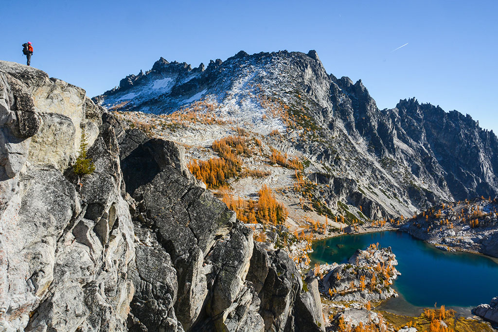
The Enchantments, Washington
Panoramic views of the Central Cascades, abundant wildlife and walking amongst ancient larch forest are some of the pleasures you’ll experience along this grueling thru-hike in the Alpine Lakes Wilderness. It’s an excellent trail for fast-and-light hikers, but if you’re visiting, consider an overnight or multi-day trip to allow exploration to the various tarns, including the aptly named Perfection and Crystal Lakes.
Most thru-hikers opt to start at the Stuart Lake trailhead instead of at Snow Lake, which cuts elevation gain by over 2,600 feet.
Distance: 18 miles (point-to-point)
Best time to hike: Late summer to early fall; be prepared for inclement weather regardless of season.
Know before you go:
- You’ll need a permit from May 15-October 31 if you’re camping; they’re distributed via lottery by the Forest Service starting in February, but there are also limited same-day permits available at the Leavenworth ranger station.
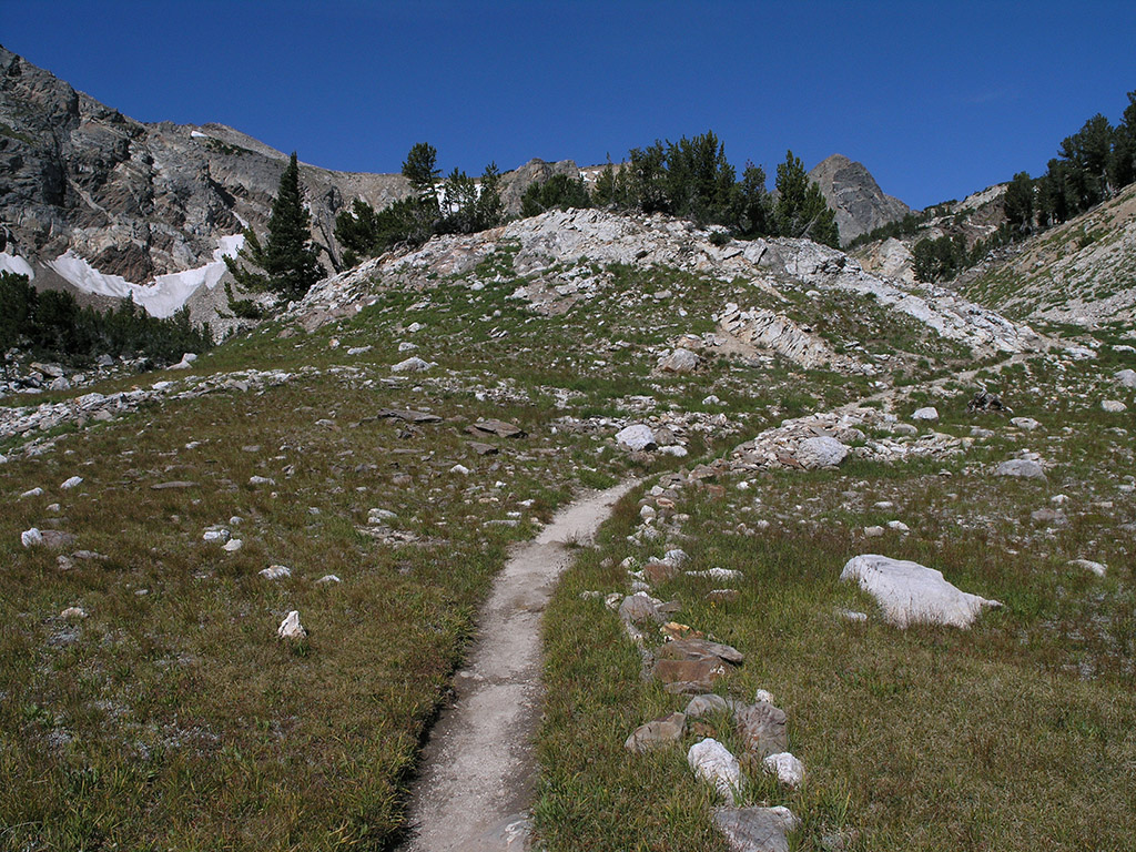
Paintbrush Divide, Wyoming
Also known as the Paintbrush Canyon/Cascade Canyon Loop, this challenging trail in Grand Teton National Park isn’t a thru-hike, but it has everything you could possibly desire when it comes to alpine backpacking: ice age glaciers and couloirs, magnificent wildlife including grizzly bears, elk and moose, verdant meadows, wildflowers and alpine lakes.
Whether you choose to make a day of it or camp, you’ll largely be able to escape the crowds found in much of the park, although the final stretch of this loop does connect with the popular Lake Solitude trail. That said, it’s easy to access the trailheads, via parking lot or shuttle boat.
Distance: 19.7 miles (loop)
Best time to hike: May-September.
Know before you go:
- By departing early from the Leigh Lake trailhead, you’ll get the best light and views of the Tetons. An ice ax is often needed through July but come prepared for inclement weather regardless and expect summer afternoon thunderstorms and windy conditions.
- You’ll need a permit to camp; they’re available from the park office in limited numbers, so reserve in advance. There are some limited first-come, first-serve backcountry sites.
Stuart Fork Trail to Emerald and Sapphire Lake, California
Yosemite and the Sierras get most of the attention (and crowds), but the Trinity Alps are equally arresting with plenty of thru-hikes. Located 50 miles west of Redding in the Shasta-Trinity National Forest, the jagged granite peaks call to mind the region’s namesake mountain range. If you enjoy challenging terrain that combines riverside hiking and diverse wooded habitat with alpine scenery, Stuart Fork is for you. In early summer, its prime wildflower viewing.
Overnighters should consider Morris Meadow, a great spot nine miles from the trailhead. Emerald Lake is five miles past the meadow; another half mile will bring you to Sapphire. Both tarns contain remnants of the prolific late 19th century La Grange hydraulic mine.
Distance: 31 miles (out and back)
Best time to hike: July-September; you many encounter snowpack
Know before you go:
- The trailhead is located at the Bridge Camp Campground, outside of Weaverville. Overnight permits are required for backcountry, free at ranger station kiosks.
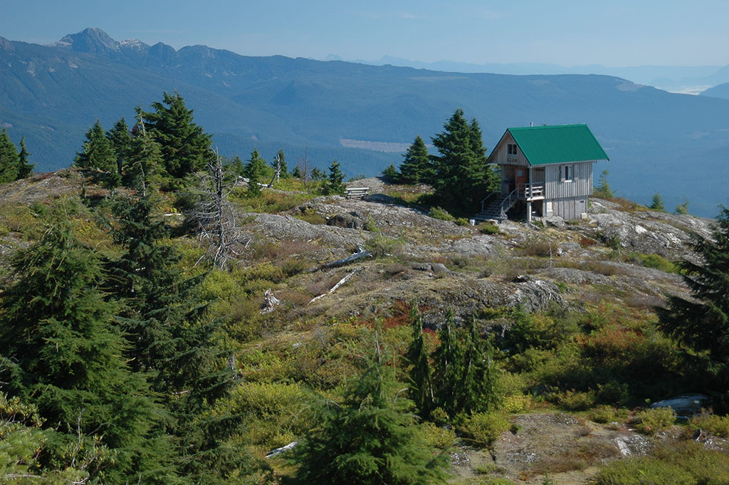
The Sunshine Coast Trail, British Columbia
Canada’s longest hut-to-hut trail is 112 dazzling (sparsely populated) miles of coastal rainforest, old growth forest, mist-shrouded mountains, waterfalls, and meadows. It’s made the list because it lends itself well to section hikes that can take from one day to a long weekend, depending upon your experience. Both the trail and 14 huts are free; the latter are first-come, first-serve. The trail comprises five major segments ranging from 18 to 34 miles; the popular Sarah Point to Shingle Mill/Powell River section (31 miles) can be a long, intense day or relaxing multi-day with options to canoe, kayak or SUP.
Distance: 112 miles (point-to-point)
Best time to hike: This being the Pacific Northwest, anticipate mercurial weather. May through September are generally the driest months.
Know before you go:
- It’s recommended you hike north to south, to avoid a 4,239-foot climb near the Southern Terminus at Saltery Bay. The Sunshine Coast Connector bus has stops along the route. Access trailheads by pre-booking a water taxi or ferry.
- Note from the Trail Crew: British Columbia recreational sites and trails have temporarily closed all of the huts due to COVID19. Hikers are encouraged to be self contained and bring a tent.
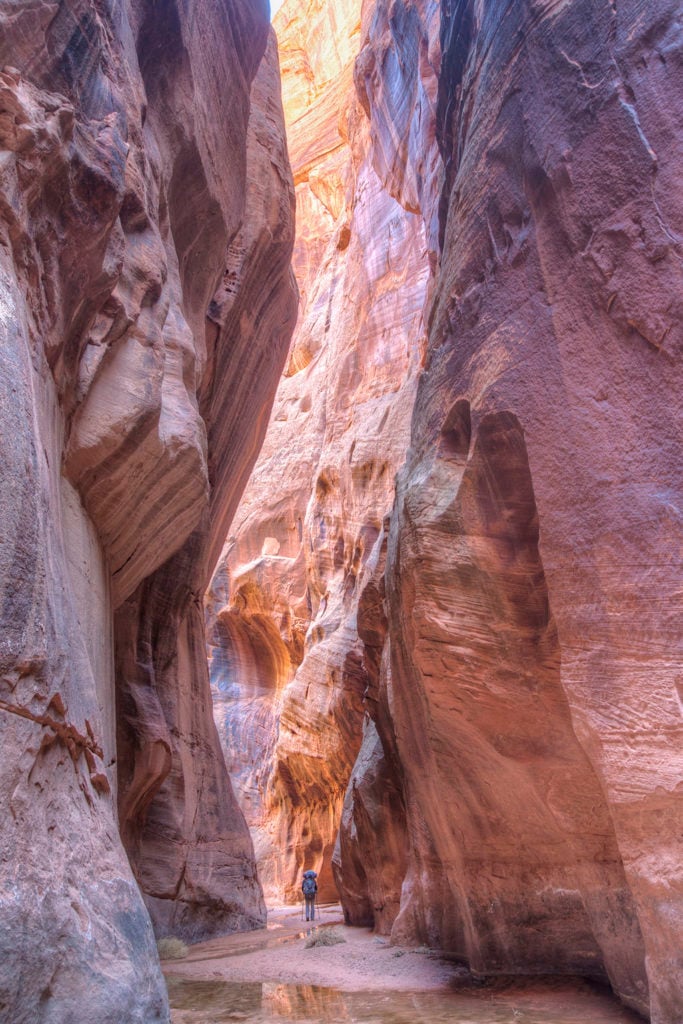
Buckskin Gulch via Wire Pass/White House Trails, Utah
One of the deepest and longest slot canyons in the world, Buckskin Gulch ranks as one of the top adventures in the Southwest, located in the Vermillion Cliffs Wilderness, on the Utah/Arizona border. This favored route includes the most scenic parts of the Gulch, with nearly 15 miles of sandstone narrows to hike, scramble and wade, and includes petroglyphs, ancient granaries, 500-foot cliffs, wildlife like big horn sheep and mule deer, and pristine—if extremely limited—campsites in Paria Canyon or at the confluence of Buckskin Gulch and the Paria River (it’s extremely silty so bring a heavy-duty workhorse filter to be on the safe side). Bonus: this hike is well-suited to all skill levels, as it’s easy to dial up the intensity due to the rock features.
Distance: 21 miles (point-to-point)
Best time to hike April-June; September-November.
Know before you go:
- Permits are required for day use; self-pay at trailheads. Reserve overnight permits (which are good for both Buckskin Gulch and Paria Canyon) up to four months in advance; pick them up in person in Kanab or St. George. Note both areas are limited to 20 people per day: there’s also a first-come, first-serve, five-site campground at the White House trailhead.
- There are private shuttles that service trailheads, but they’re pricey; having two cars is the best option if you’re not solo.
- You’re required to use human waste bags in Buckskin and Paria Canyons; you’ll be given some when you pick up your overnight permits but bring a shovel.
- Torrential rain can happen at any time and it can get cool in the narrows regardless, so bring lightweight but appropriate clothing and heed all flash flood warnings.
The Ridge Trail, Virginia/Kentucky
If you love the thought of a thru-hike in southern Appalachia but want to skip the AT masses, you’ll love Cumberland Gap National Park. The Gap is a geographic feature that allowed Native Americans and 18th century pioneers—including Daniel Boone—passage through the otherwise impenetrable Cumberland Mountains. It’s on the Kentucky-Virginia border near Middlesboro, a quarter mile from where the states converge with Tennessee.
This strenuous, unpopulated trail traverses the park, with frequent changes in elevation. Numerous overlooks yield outstanding views of bucolic valleys, limestone cliffs and abundant forest (fall is the optimum time to visit, when the foliage blazes with color and the annual hawk migration occurs; up to 10 raptor species can be spotted in the skies above the Ridge). If you’re a history buff, you’ll want to allow time to explore the park’s historic sites and artifacts.
Distance: 21 miles (point-to-point)
Best time to hike: Spring and fall; September-October are peak times for hawk migration.
Know before you go:
- Camping requires a backcountry permit, free at park visitor centers.
High Falls Loop Trail, New York
Described as a moderately difficult, “long woods walk” by Visit Adirondacks, this loop, situated on the upper Oswegatchie River in the Five Ponds Wilderness, features old-growth white pine forest, beaver ponds, blueberry bushes and the option to access the trailhead—located near the town of Wanakena—by canoe or kayak. If you’re a Nordic enthusiast, High Falls also makes for first-rate snowshoeing/skiing.
Many hikers prefer to make this an overnight trip so they can explore side trails like Cat Mountain. For camping there are a handful of lean-tos on the riverbank and off a spur trail.
Distance: 18 miles (loop)
Best time to hike: June-March and winter months
Know before you go: It’s strongly recommended to make this an overnight trip in winter conditions.
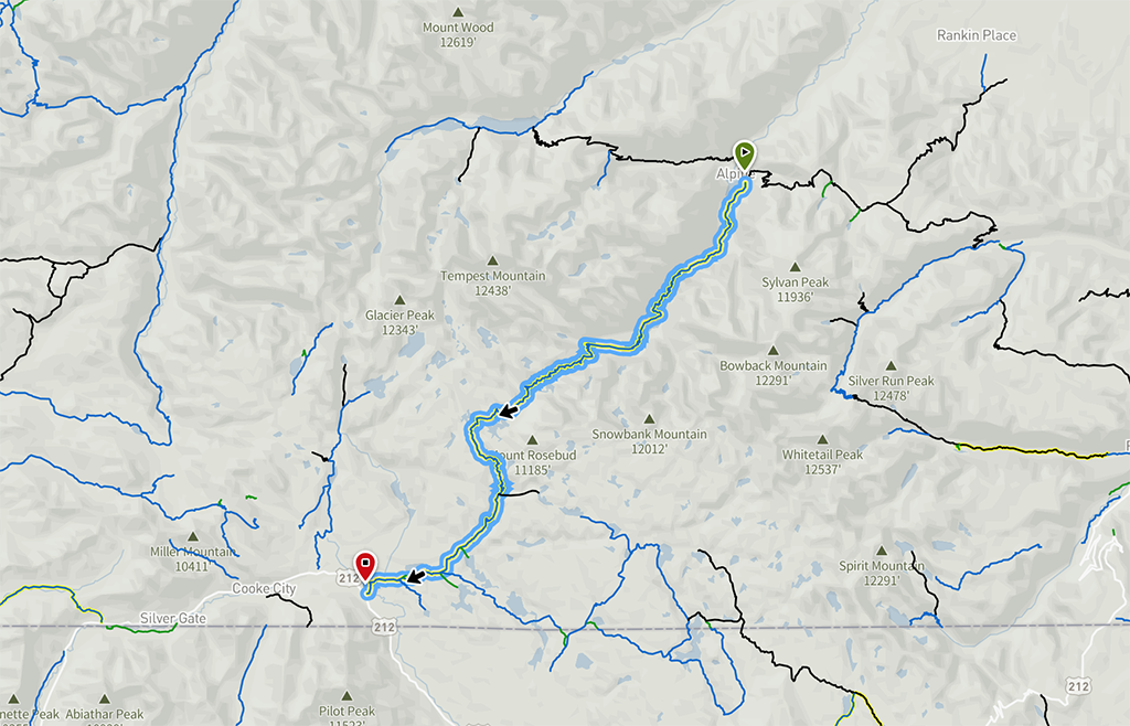
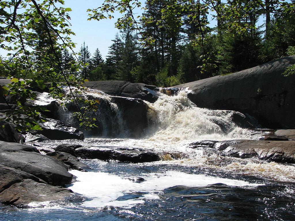
The Beaten Path Trail, Montana
Accessing the trailheads requires a drive of at least several hours, but the route along the spectacular Beartooth Highway (accessible from Cooke City or Red Lodge) is reason enough to undertake this traverse. Located in the Beartooth range of the Absaroka-Beartooth Wilderness, The Beaten Path is considered one of Montana’s top backpacking destinations, boasting the highest peaks. You’ll encounter over a dozen azure tarns, pristine forest, wildflower meadows and loads of wildlife on this challenging hike that also makes for an excellent multi-day trip with plenty of side treks.
You can hike from either direction; starting at the Clarks Fork Trailhead (3.5 hours from Bozeman) has less elevation gain, but the most impressive views are from the East Rosebud Trailhead. No permits are required.
Distance: 26.2 (point-to-point)
Best time to hike: Late July-September; you may encounter snowpack.
Know before you go:
- You’ll have to shuttle to either trailhead; your options are taking two cars or doing a swap mid-hike. This is also grizzly country, so hike prepared.
Gear essentials for short thru-hikes
Even if your weather app predicts bluebird skies, it’s always smart to hike prepared for inclement weather and emergency camping. Prepare for outings by researching your route and always let someone know where you’re going and when you’ll be back. Don’t forget to bring more food, water and sunscreen than you think you need, and invest in a great daypack, hiking boots/shoes and moisture-wicking hiking socks.
- Sunscreen/sunglasses
- First aid kit
- Sun hat
- Insect repellent
- Windproof jacket and/or water-repellant/proof jacket
- Insulating, moisture-wicking layers
- Hiking poles
- Compass/map
- Head lamp
- Matches
- Toilet paper/trowel for long hikes
- Knife/multi-tool
- Nutrient-dense snacks
- Electrolyte tablets/powder
- Hydration reservoir
- Water filter, like MSR’s Thru-Link™ Inline Water Filter, which snaps into your hydration reservoir for fast, automatic filtration.
- Water purification tablets like, Aquatabs, as backup for viruses
- Emergency shelter, like MSR’s E-Bivy™
 Laurel Miller is an Austin-based food, spirits and travel writer and editor. Despite her Texas locale, she’s obsessed with the mountains and whitewater, but breakfast tacos run a close third. She’s at sustainablekitchen.com.