Baffin Island Exploration: A Trip to the Edge of the World
Baffin Island is the world’s fifth-largest island. It lies mostly north of the Arctic Circle in Canada’s Arctic Archipelago. It is absolutely wild, perched on the fringes of our global, Westernized society. Baffin Island is the indigenous land of the Inuit, who have lived and thrived there for thousands of years. We were incredibly fortunate to travel on these lands, and to receive advice and guidance from a local Inuk outfitter. Today, Baffin Island is part of Nunavut, the most northern territory in Canada.
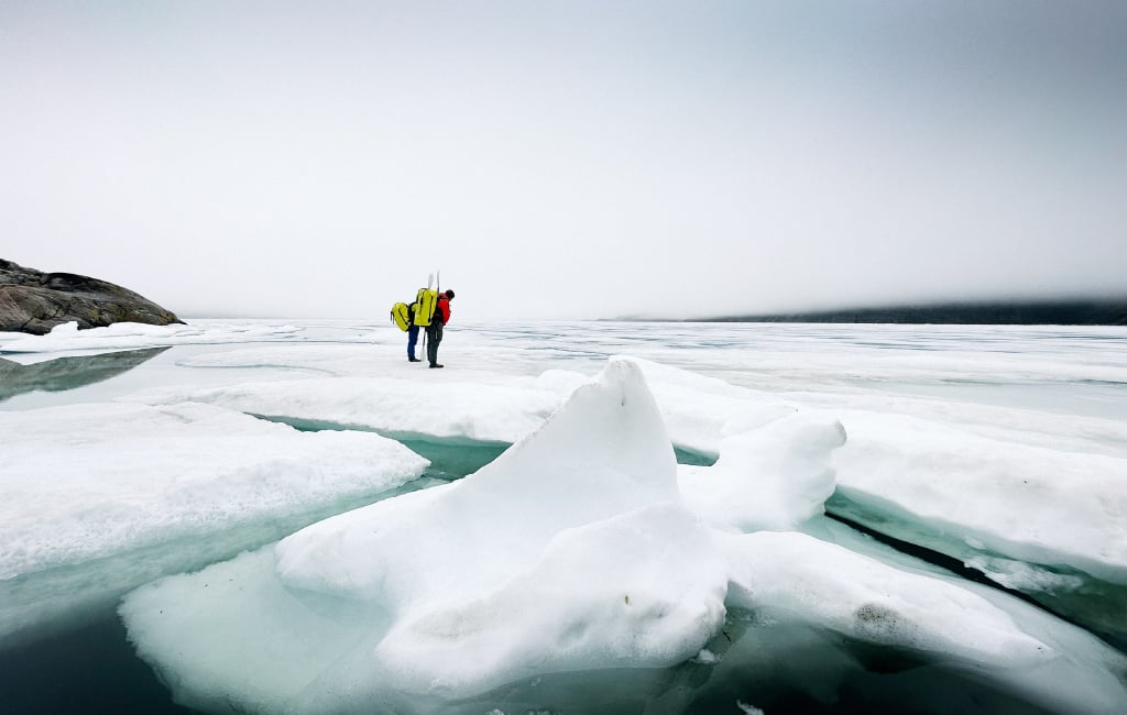
Baffin Island is cold. The average annual temperature is well below freezing, and summers are cool and brief. Baffin exists north of the arctic treeline, with only barren arctic tundra or ice cap and glaciers covering every inch of this immense island. Traveling in Baffin varies widely depending on the season, which determines the amount of daylight, as well as the presence of sea ice. For most of the year, the ocean around Baffin is frozen over, making any sort of backcountry trip a snowy affair. During this time, people will typically travel either by ski or by snowmobile. For a brief period in the summer (typically July, August and September), the ocean around the island is unfrozen and open.
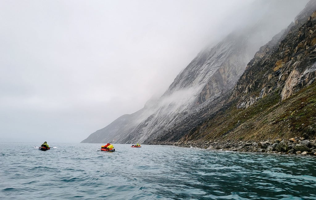
This brief window in the summer was when we chose to travel. The open water allowed us to kayak, which made carrying large amounts of gear much more practical.
These months also afford almost non-stop daylight, as opposed to the never-ending darkness of winter. Finally, when traveling on the east coast of Baffin (where our trip took place) one should always consider migratory wildlife. Our primary concern was the polar bears, which spend early summer out on the sea ice and migrate inland in later summer. This meant we’d be directly on their migration route as we paddled back home at the end of our trip. We prepared ourselves for this danger by erecting electric fences around our camp and carrying firearms when in the most hazardous areas.
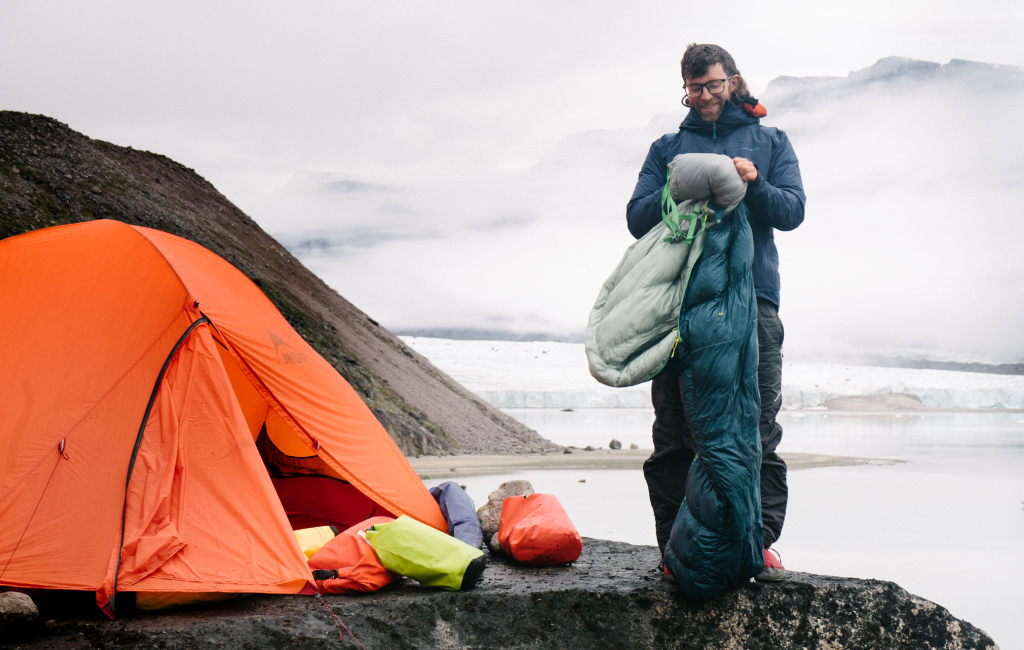
The Art of Packing for a Sea Kayaking and Climbing Expedition

How much to pack?
Our group of four traveled for six weeks into a remote and wild part of Baffin Island. We traveled on foot over sea ice, by sea kayak over water, and then on foot again over glaciers and loose rocks. Once we arrived, we did large, unexplored rock climbs, then did it all over again in reverse. Packing for a trip like this posed numerous challenges, and we found ourselves devoting lots of time before and during the trip to reorganizing and repacking with each new phase of the trip.
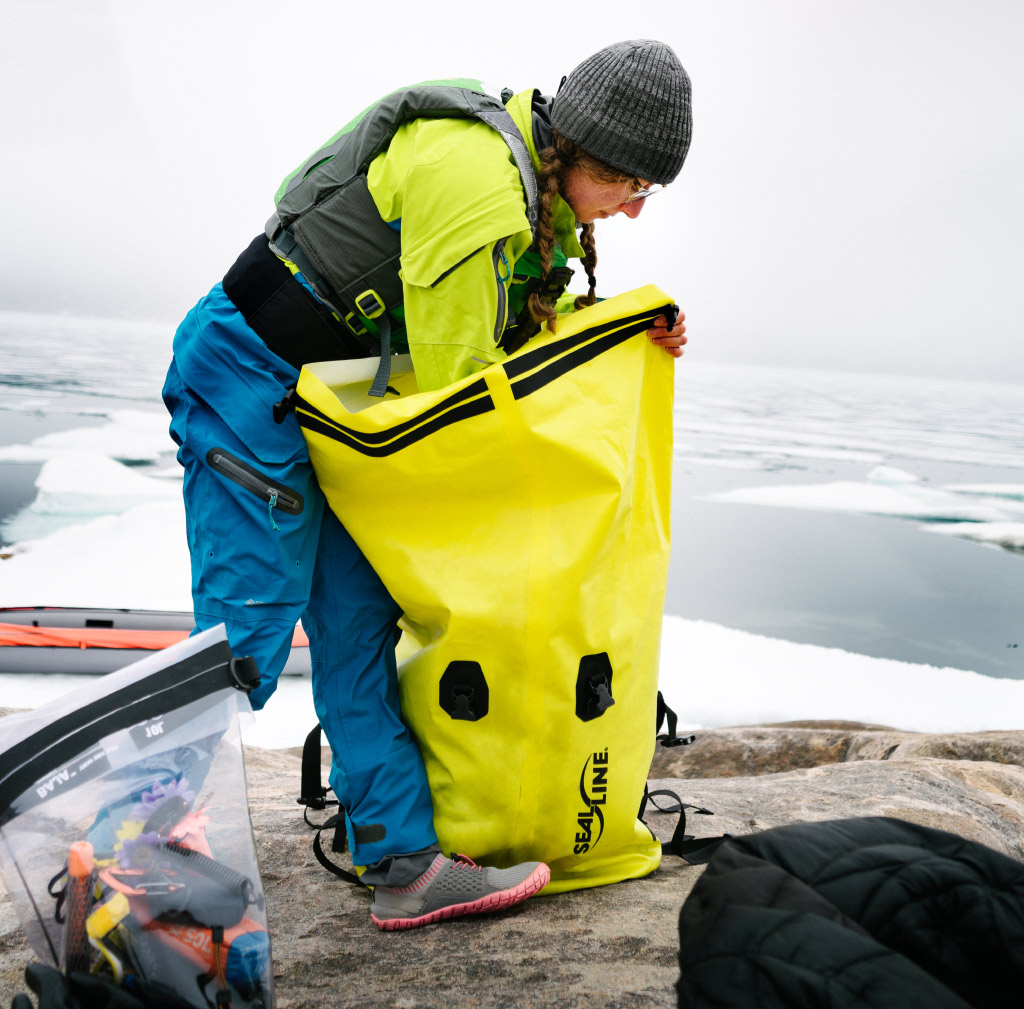
For the paddling section, our first and largest challenge was fitting the massive amount of gear we had (almost 1000 pounds, including our kayaks!) into SealLine® dry bags. Our main limiting factor here was space in our kayaks, as well as maintaining organization. As our kayaks were stuffed to the brim with gear, we found it all stayed secure and stable during our paddle. Any items that we needed quick access to were lashed to the top deck of the boats.
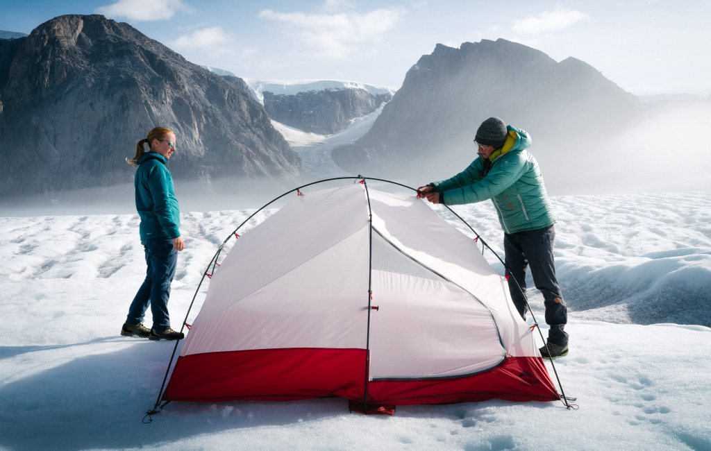
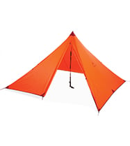
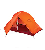
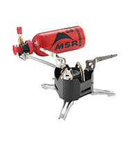
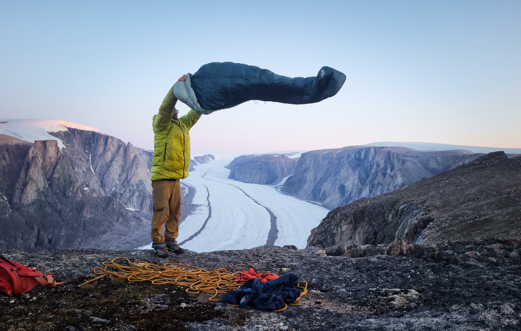
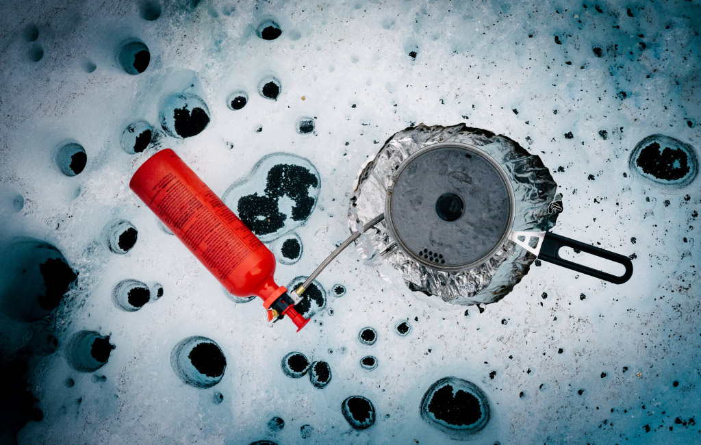
Additionally, we used some extra precautions for certain gear that would be particularly disastrous to get wet. Down sleeping bags, puffy jackets, tents, (etc.) were wrapped in trash bags inside of our dry bags, just for backup protection. Some of the most important things that we found ourselves using almost every day were puffy layers–both top and bottom–to help us handle the arctic cold, our tents, and a separate Front Range tarp shelter, which was essential for cooking on rainy days. In addition to these items, we used the classic backcountry camping essentials such as reliable liquid fuel stoves, gravity water filters, warm down sleeping bags, and pads for sleeping and sitting on.
Where to pack it?
Once we sorted through what to bring and managed to put our entire mountain of gear into dry bags with a workable level of organization, the next step was to load things onto our boats. We had two options for loading things onto boats, putting bags below deck or strapping bags onto the outside of the kayaks. Step 1 was to put heavy items that we wouldn’t need to access during the day below deck. For us, this meant climbing gear, bear fences, and foods that we would only be accessing in the mornings and evenings. We tried to put weight below deck as much as possible to keep our boats stable in the water. For the rest of our gear, we utilized tons of cord to strap our gear to the outside of our boats with an eye toward keeping weight as centered and balanced as possible. Finally, we would load one small dry bag with gear that we would potentially need to access easily during the paddle (such as snacks and water, rescue throwline, bear bangers, etc.)
Food and Water Considerations
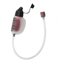
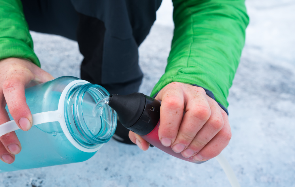
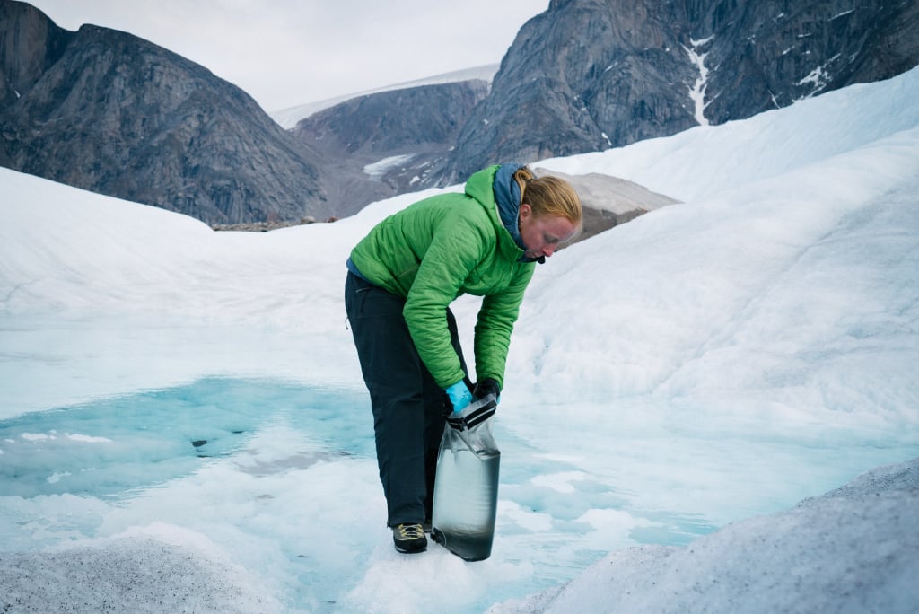
Staying fueled over such a long trip also presented quite a few challenges for us to figure out. First was water. Every time we found a new spot to camp, we had to make sure to locate a nearby water source. As the Arctic has ice year-round, this typically took the form of streams running downhill from the nearest snow patch, or even along the surface of the ice when we camped on glaciers. We always made sure to designate a good spot to fill up our water containers upstream of our camp to prevent possible contamination of the water and utilized MSR gravity filters to reduce our chance of waterborne illness. Water presented a much greater challenge on our long alpine rock climbs, and we found ourselves feeling pretty dehydrated as we topped out our two longest routes. Luckily at the tops of those routes, we were able to find small trickles of water running in low points in the boulder-covered tundra. For these situations, we used the extremely handy MSR TrailShot pocket filter pump, which allowed us to get water out of extremely shallow pools and trickles.
Food presented another huge logistical challenge for us on the trip. We each packed our food a little differently, with the biggest challenge being packing enough and in sufficient variety to maintain adequate nutrition. For the most part, we used total calories as a good benchmark to determine if we had the right amount of food. We further broke that down into an amount of calories per day, which varied for each of us. For example, I planned my meals out by attempting to consume at least 3,500 calories a day. Additionally, we all made sure to have a variety of different things to eat for each meal, both sweet and savory. Nothing is worse than finding yourself with only sweets for weeks at a time on an expedition. Examples of good savory snacks with a high amount of salt to replace electrolytes include salami, cheese, powdered hummus, and pretzels. We got some much-needed extra calories by bringing a large amount of butter and adding it to meals.
Safety Precautions and Emergency Preparedness
Safety was a huge concern for us on a trip this large remote. We took a ton of different measures to keep ourselves as safe as possible. First and foremost, was making sure to have satellite communication devices (more than one) and having a check-in plan with multiple different contacts. Each group member brought a satellite communication device, and we each made our own independent check-in plans. These varied from every day to twice a week and just depended on our own individual contacts. For this plan to work well, we also made sure to connect all of our individual check-in contacts with each other. This is a key part of this plan because devices can malfunction or lose battery power, or any number of other issues, so we directed our emergency contacts to contact the other members of the trip and the other contact people if any of us ever missed our pre-planned check-in time. Our cell phones were an essential tool for this trip, both for the check-ins, as well as for navigation, as they provided the primary mapping and navigation system for our team. We each made sure to download maps onto our preferred navigation app, generally either Gaia GPS or Caltopo, before the trip. We also brought backup paper maps and a compass, although we never had to use these things at all. In order to make sure we didn’t lose battery on cellular devices, we also brought along external battery packs and miniature solar panels to keep everything charged.
Our general policy of having backups for all our emergency gear was extended into first aid kits as well. We brought multiple small first aid kits for dealing with serious accidents while climbing or paddling, as well as a larger camp first aid kit with supplies to help us deal with longer-term care. We brought a variety of medications including antibiotics, meds for stomach problems, and general painkillers.
Finally, the most unique type of safety gear that our team carried was a pair of 12-gauge shotguns. We had these firearms for our paddle out, the time during our trip when we would be most likely to see polar bears. Generally, other mitigation strategies like bear spray and bear bangers are adequate for grizzly and black bears. However, after extensive research and conversations with locals, we determined that for polar bears, firearms were necessary.
Planning and preparing for our trip to Baffin Island was a huge challenge, from packing our boats and keeping ourselves safe from polar bears to planning for uncertainty in an extremely remote area of the world. We couldn’t be happier with our choice to do it though. We all felt incredibly grateful to be privileged enough to take this unforgettable journey to Baffin Island.
Related Posts: