Snow Safety Tools: 7 Apps to Help You Stay Safe in the Backcountry
By Ali Carr Troxell
Up until now, technology didn’t really exist in the realms of snow safety and weather prediction. Inclinometers, paper topo maps, online weather websites and walkie talkies aren’t what we’d exactly call 2.0. Be a Luddite no longer and grab that smartphone—the app world has stepped up with a handful of ways to make your life easier when it comes to staying safe on the snow.
WEATHER PREDICTION
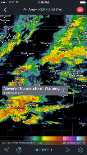
RadarScope ($29.99): Weather geeks and meteorologists will love this app for its depth of weather info—sent directly from the National Oceanic and Atmospheric Administration. Overkill for most, but for precise storm forecasting, it’s the one to have. iPhone and Android.
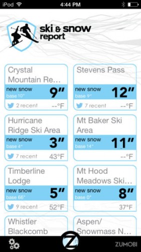
Ski and Snow Report (free): Set an alert and you can find out when more than, say, twelve inches of snow falls near you. That’s because the Ski and Snow Report app has reliable data being posted by real staffers at all times. Check out their five-day forecast or look at web cams for current conditions. Then, grab your skis and go. iPhone and Android.
AVALANCHE FORECASTS
Ullr Labs Mobile Avalanche Safety Tools ($9.99): Everything you need to know about current avalanche conditions including forecasts from avy centers around the country, cross-sections of recent snow pits, and the data on recent slides. Get beta from those who have gone before you: This app features crowd-sourced observations from local users. iPhone and Android.
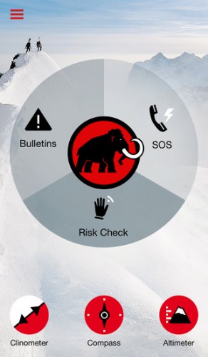
Mammut Avalanche Safety (free): This all-in-one app not only touts avalanche advisories from all over the world, it allows you to measure the level of risk you’re about to embark upon by entering info like slope angle and exposure. It even includes tools to make the measurements yourself. And, like the Rescue Kit app below, an SOS function alerts search and rescue of your GPS coordinates in an emergency. iPhone and Android.
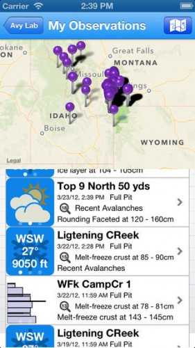
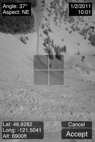
Avalanche Lab (free, or get the pro-version, $14.99): Your digital avalanche field notebook, the Avy Lab app lets you create a profile for any avalanche you come across—and submit it to a crowd-sourced database. Snap a photo, measure the slope angle, record the crown size, and even map the slide with your phone. iPhone only.
STAYING CONNECTED
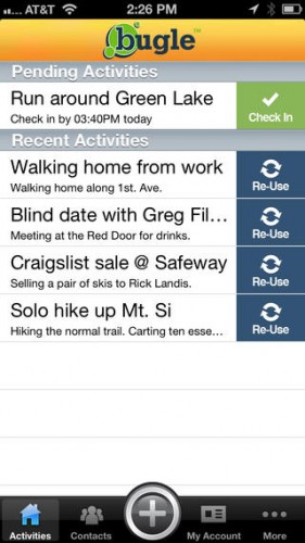
Bugle (free): Set a check-in time for yourself, your activity and your emergency contact. Then, head out the door. If you don’t check back in on time, this app will notify your contacts and give them the info they need to look for you, iPhone only.
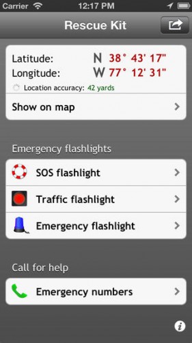
Rescue Kit ($1.99): A simpler version of the SPOT beacon, Rescue Kit detects your GPS coordinates and sends them to rescuers when in need. Equipped with colored SOS flashlights to help that heli find you between the trees. iPhone only.
 Ali Carr Troxell is an outdoor gear expert, adventure travel writer, television personality and PR maven for Coleman Outdoor Brand at Hayter Communications. Her most recent stint included editorial strategy and execution at Microsoft to launch their in-house travel and food and drink apps, with global audiences in the millions. She was also an editor at Outside magazine for almost six years. Away from the desk, she loves to explore her Pacific Northwest home, doing everything from hiking and camping to backcountry snowboarding, and surfing. She is a certified yoga teacher.