On May 6th 2014, I reached the Geographic North Pole after what I can only describe as the most difficult 53 days of my life. Sitting in my chair now, with the perspective of time and distance, I am amazed that I was able to persevere long enough to be successful. After all, no one had completed a North Pole expedition since 2010 and comparatively few over the span of polar history.
In 1995, Reinhold Messner, easily the most accomplished mountaineer of all time, called his unsuccessful attempt to reach the North Pole, the horizontal Everest. While over 6,000 people have summited Everest only 250 people have traversed the Arctic Ocean from land to the Geographic North Pole—less than 50 of those traveling unaided and un-resupplied (meaning pulling all your food and supplies from the start without the assistance of sled dogs, kites or any mechanical device).
To understand why this particular adventure is so difficult, you need to know a little more about the Arctic Ocean itself. It’s huge—5 and a half million square miles (that’s larger than all of Europe) and plunges to the depth of 14,000 feet. Temperatures range from a balmy just-above-freezing in the summer to nearly 80-below in the winter. Eight countries frame the Arctic Ocean: Greenland, Iceland, Norway, Sweden, Finland, Russia, Canada and the USA (Alaska), but perhaps the most unique feature of all, is the fact that nearly the entire ocean is covered in a thin sheet of ice. Because all that Arctic ocean ice is floating on water, it does all sorts of crazy things due to wind tides and ocean currents. The ice is broken up into sheets or pans that can be up to several miles wide. Pans can crack and form open sections of water called leads. Or they can collide together. Freeze and refreeze forming pressure ridges, rubbled ice, vertically heaved slabs and every other possible combination.
Oh yeah, and there are polar bears. Hungry polar bears.
What follows is a photo journey of our 480-mile journey from Cape Discovery on northern Ellesmere Island to the Geographic North Pole. My hope is that by looking at these images you will gain a more in-depth perspective into what I believe is one of the most difficult expeditions on the planet, to a place that few people understand and that may be the last of its kind in history due to climate change.
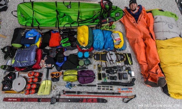
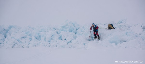
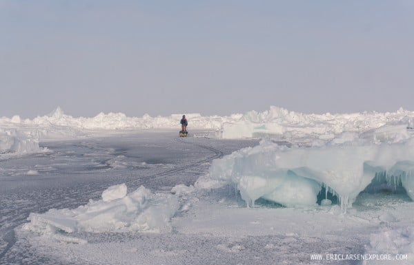
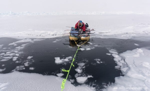
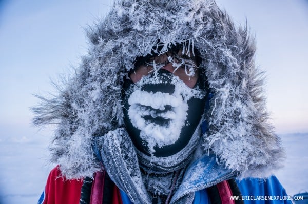
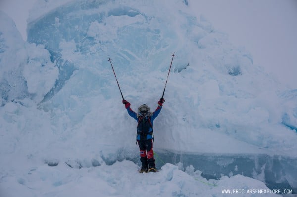
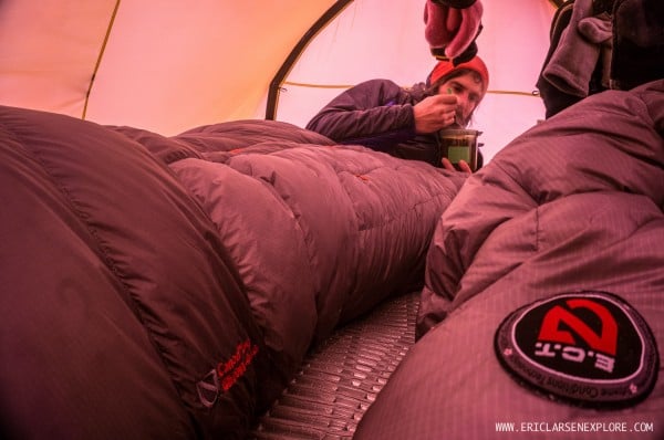
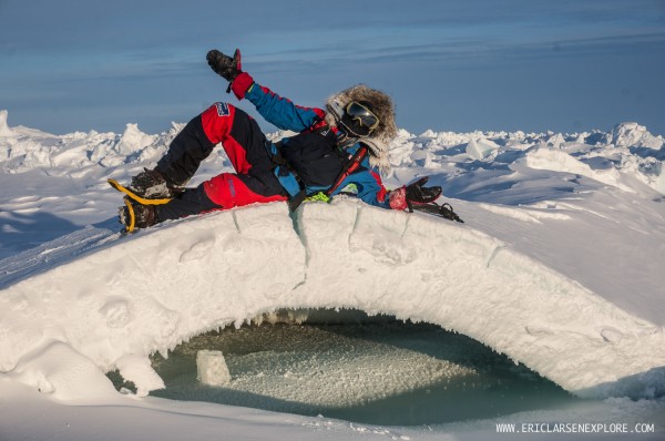
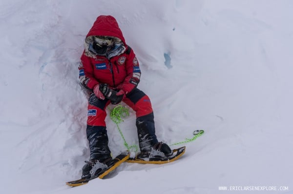
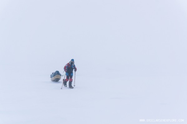
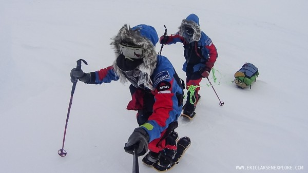
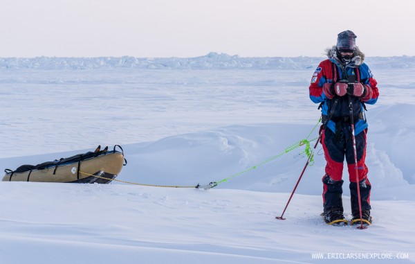
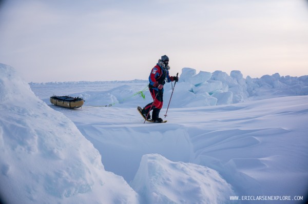
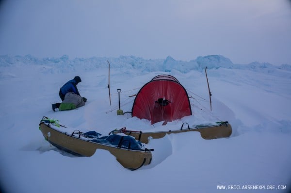
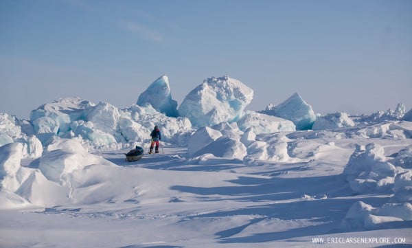
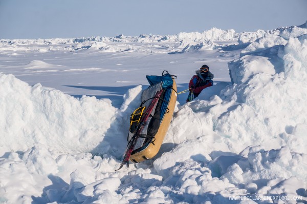
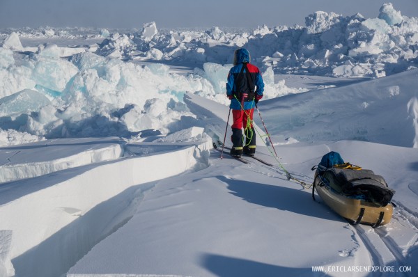
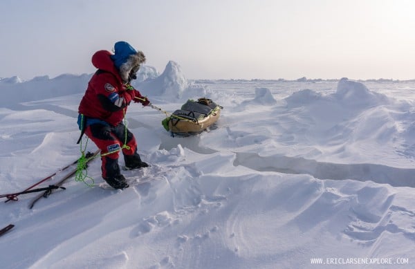
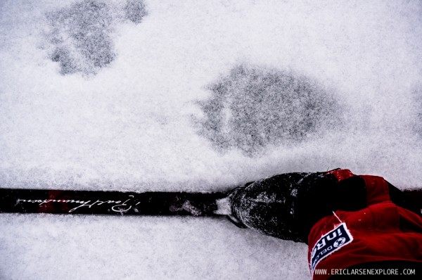
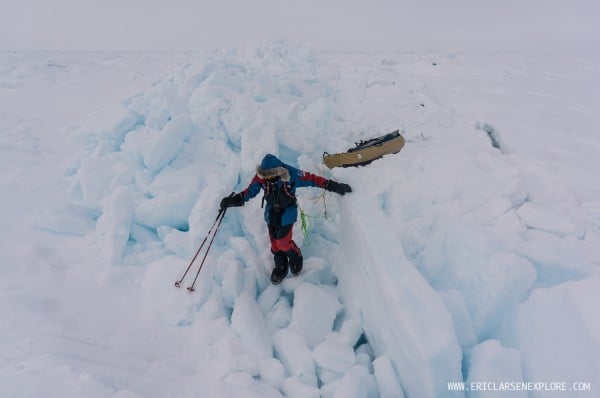
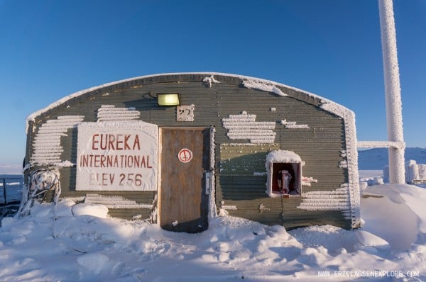
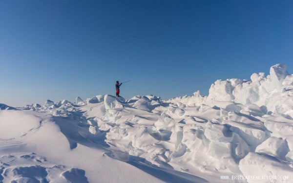
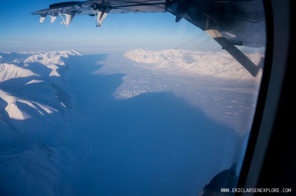
Pressure ridges form where pans of ice collide. Most often we would try to find routes around, but unfortunately, equally as often there was no other clear route and we were forced to pull our heavy loads up an over. Our MSR Lighting Ascent snowshoes provided critical traction.Skirting the edge of a newly frozen lead means we can avoid the large slabs of pressured ice if only for a hundred yards or so. We often used our modified MSR Flight poles to test the stability and safety of thin ice. Three swift jabs and no water means the ice was safe enough to cross.Traveling on the Arctic Ocean is your basic ‘anything goes’ situation. When crossing open water leads, we would often catamaran our sleds together with our skis and ferry ourselves across.While temperatures weren’t as cold as I’ve experienced in the past, 35 degrees below zero still means that sweat freezes almost instantly.It’s hard to understand exactly the forces of nature that are responsible for breaking up large sheets of ice and pressuring them together. We were amazed to see blocks of ice the size of houses heaved up 15-20 feet in the air.Breakfast in bed on the Arctic Ocean is a luxury. Every morning right after waking up, we would bring our sleeping bags outside to avoid moisture build up inside the bags. During our last few days however, we were so tired and our fuel was so low that we simply melted snow and ate lying down. As a side note, I’ve used the MSR Titan Spoon on every single expedition I’ve been on for the last 10 years.Trying to keep things ‘sexy’. We were always surprised to see different shapes and forms of ice, this one was an especially interesting arc.Break time, huddled behind an ice chunk for ‘warmth’.White out on the Arctic Ocean. Brutal at best. These conditions were soul-breaking as we couldn’t even see the snow underneath our snowshoes. It was like being on the inside of a ping-pong ball. Worse, we couldn’t tell if we were navigating toward flat ice or rough ice.At the beginning of the expedition, our sleds were so heavy (320 pounds) that we had to double pull each sled and then go back and get the second sled. That meant for every mile we traveled North, we actually covered 3 miles of ice…. and its not like we were making great mileage either. For the first three weeks, we averaged around 2.5 miles per day!Finding North. Ryan stopping for a few moments to get his bearing. We navigate during the day with a compass as it is more reliable and saves battery power.When we put on our Lightning Ascents it was like engaging four wheel drive. They provided critical traction in the rough ice.Home sweet home on the Arctic Ocean.Trying to find a path where there is no path. We had been stuck in some of the worst ice we had seen when we spotted a small ‘clearing’. After a short scouting trip, we got through this line of pressure into a small open pan. The day before we had struggled for nearly 4 hours to make less than a mile. Finding this small bit of open ice – even as small as it was – was a huge boost to our weary bodies and minds.No comment. #notfunLater on in the trip we would switch back and forth regularly between skis and snowshoes. While it took a bit of time to make the switch we were much more efficient in rough ice with snowshoes as well as open ice with skis.Ryan had just skied over this crack but by the time I had gotten there, the crack had widened far enough that my skies would span the gap. I took my skis off, jumped across and then pulled my sled over.After nearly two months without a shower, I can only imagine we smelled like two all beef patties to a polar bear (and our tent was the Big Mac wrapper). We had two polar bears sneak up on us during the first week of our expedition (yes, it was scary). Then, we came across these ginormous tracks near the North Pole.Yet another pressure ridgeEureka International – We left Resolute on March 15 and stopped to refuel at a very remote weather station on Ellesmere Island. We did jumping jacks to stay warm in the 35 below zero temperatures to stay warm as the hand rolled barrels of A1 jet fuel to the plane.Scouting a route through some really bad pressured ice!Flying over Ellesmere Island in crystal clear skies on our way to Cape Discovery.