A Recon Mission in Patagonia
By Eric Larsen
The crew from MSR sent me a quick note asking if I would share details from my recent reconnaissance trip to Patagonia. They were specifically wondering about my gear, if I achieved my goals and how might this trip be different from last year’s North Pole expedition. Legit questions for sure, but the last one made me smile.
For starters, comparing anything to the Arctic Ocean is impossible. Traveling unsupported to the North Pole has an off-the-charts difficulty quotient. Riding horses into a remote Patagonian valley in the summer trying to climb up the tongue of a glacier—well, that’s basically a vacation in comparison.
But our trip to Patagonia wasn’t a vacation. Instead, it was a work trip (OK – you got me, I don’t really consider what I do work but it is my profession). My expedition partner, Ryan Waters, and I are in the initial stages of testing gear and training for a larger crossing of the Southern Patagonia Ice Sheet. Equally important, we wanted to scout an ‘exit’ point of the ice sheet crossing so that after 50 days of intense glacier travel, we would be able to get back to Puerto Natales without incident, injury or worse.
Easier said than done, but more about that later.
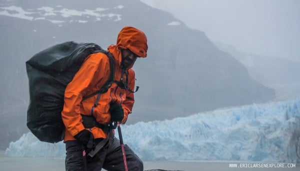
The prospect of trekking into the Patagonia ice cap in December means you will experience a potpourri of the world’s worst weather: high winds, rain, deep snow, white outs… you get the idea. Despite the fact that packing for a trip like this is fairly straightforward (compared to a big polar expedition) we had to prepare for nearly every weather extreme. Shorts to big down jackets. Snowshoes, pickets and ice axes.
MSR gear along for the ride, you ask?
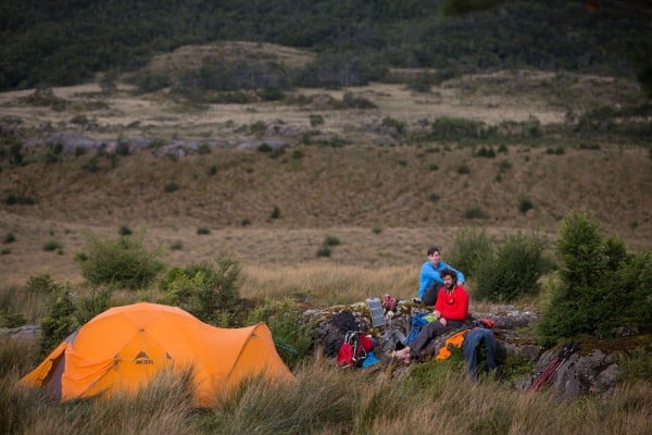
Stormking 5 person expedition tent
Flight 2 & Flight 3 winter poles
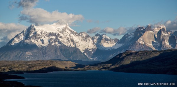
The Southern Patagonian Ice Field, located at the Southern Patagonic Andes between Argentina and Chile, is the largest non polar ice cap on earth, and the third glacier mass in size after Antarctica and Greenland. And to date, no one has completed the 400 kilometer north-south traverse in an ‘unsupported’ and ‘unaided’ style.
My process with any big adventure (especially when you’re talking about something that no one has ever done before) is to start with a list of questions:
What will the conditions be like?
Temperatures?
What kind of equipment will we need on the ice cap?
How will we traverse the many large crevasses?
What route will we take to get on the ice cap on the northern end?
If we’re able to sustain the nearly two-month effort, how will we descend from the ice cap and return to civilization?
What in-country logistics could we arrange?
Our goal with this trip to Patagonia was to answer the last two questions. If conditions permitted we would access the ‘end’ point of our traverse at the top of the Balmaceda Glacier using my DeLorme inReach to map a safe ‘route’ from the ice field down to terra firma. Additionally because the ice cap traverse required an equal combination of mountaineering and polar skills, we simply wanted to get a better ‘feel’ for the environment to help answer the next set of questions.
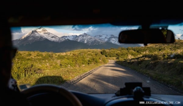
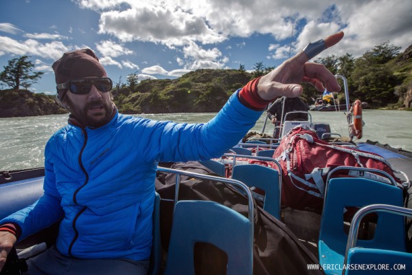
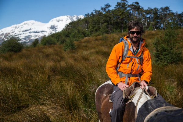
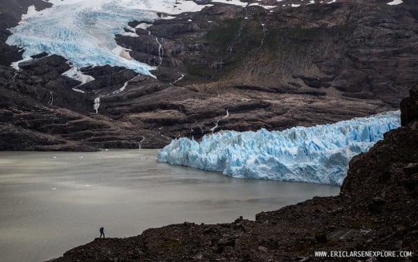
Once in Chile, we made our way to Puerto Natales, where we arranged a complicated series of logistics involving a van, zodiac boat and horses from a local rancher. After a day-long horseback ride, Ryan, Josiah (my camera man) and I were unceremoniously dropped several miles from the glacier.
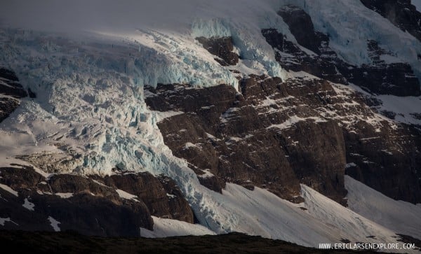
Over the next five days we relayed gear, battling constant wind and rain, trying to find a route onto the Balmaceda Glacier. After failing once, heading back to camp to resupply and heading out again we reached a humbling conclusion. The glacier had melted too far back and water and sheer cliffs blocked our access.
I’ve been going back and forth on our adventure here and what it means. It’s hard to ever really describe all the work, planning and effort that goes into preparing for a major expedition—especially one that has never been completed before. On the surface, we were not able to accomplish our main mission of gaining access to the Balmaceda Glacier, a potential exit point of a future larger (much larger) expedition. I don’t like to say that things are impossible, but this was.
On the other hand, the whole purpose of a reconnaissance trip is to determine what is possible and what isn’t. What logistics are necessary. Which routes offer quick and easy access. Who is trustworthy. Who had good horses. In that sense, our trip was hugely successful. We are coming home with considerable ‘beta’.
It will take a while to process all this and begin planning for the next steps. But this is all the part of the process. And one of the things I’ve learned on expeditions is that problems are only problems if you let them be. There is a solution. You just have to be willing to keep at it long enough until you find one.
Think Snow!