Thru-Hiking the PNT: The Last Hike on the Pacific Northwest Trail
Editor’s note: Triple Crowner Quoc Nguyen undertook the PNT in the fall, a feat that should be reserved only for expert thru-hikers and those with extensive avalanche education and winter backcountry experience. Below he recounts his journey and provides tips for anyone thinking of thru-hiking the Pacific Northwest Trail.
5 author tips for hiking the Pacific Northwest Trail located at the bottom.
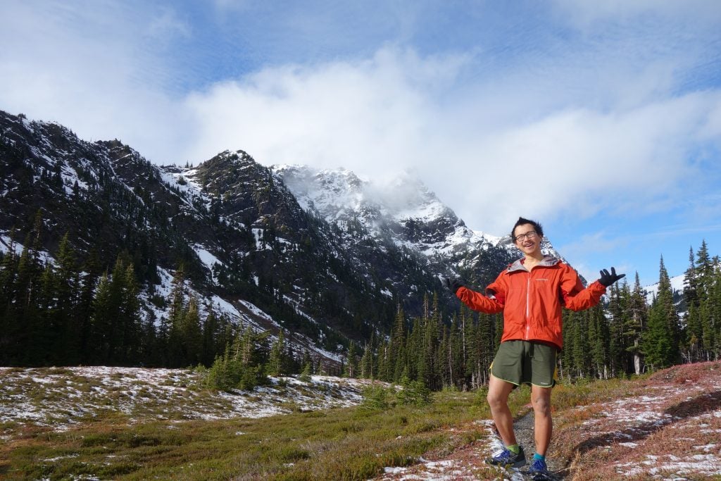
On the second day of autumn, September 23, 2016, I began my thru-hike of the Pacific Northwest Trail (PNT). The “perfect” time to trek the 1,200 miles from the Continental Divide to the Pacific Ocean had already passed, but perfect isn’t very exciting. I welcomed the change of season. The time for snow was set to arrive, and snow always transforms the mountains into a magical place.
As I slapped the wooden pillar of the Chief Mountain Customs building and officially started my walk, I knew many challenges lay ahead. Through varied terrain of snow-capped mountains to rugged beaches, the PNT proved to be a trail unique in its own right and an incredible adventure.

Snow Dangers Awaiting
I started this trail not knowing whether I would actually finish. Thru-hiking this late in the season has the added danger of snow. I was always ready to quit if conditions became too dangerous. This hike was not the typical PNT experience; it was the most late season thru-hike of the trail known to date. I decided to go for it because I was nearby, and it was there.
Grandeur of the Divide
For a westbound journey, the PNT starts with an immediate bang—Glacier National Park, the crown jewel of the National Park system. The mountains inside the park are simply spectacular and unparalleled to anywhere else in the U.S. As an added bonus, it’s also prime grizzly country!
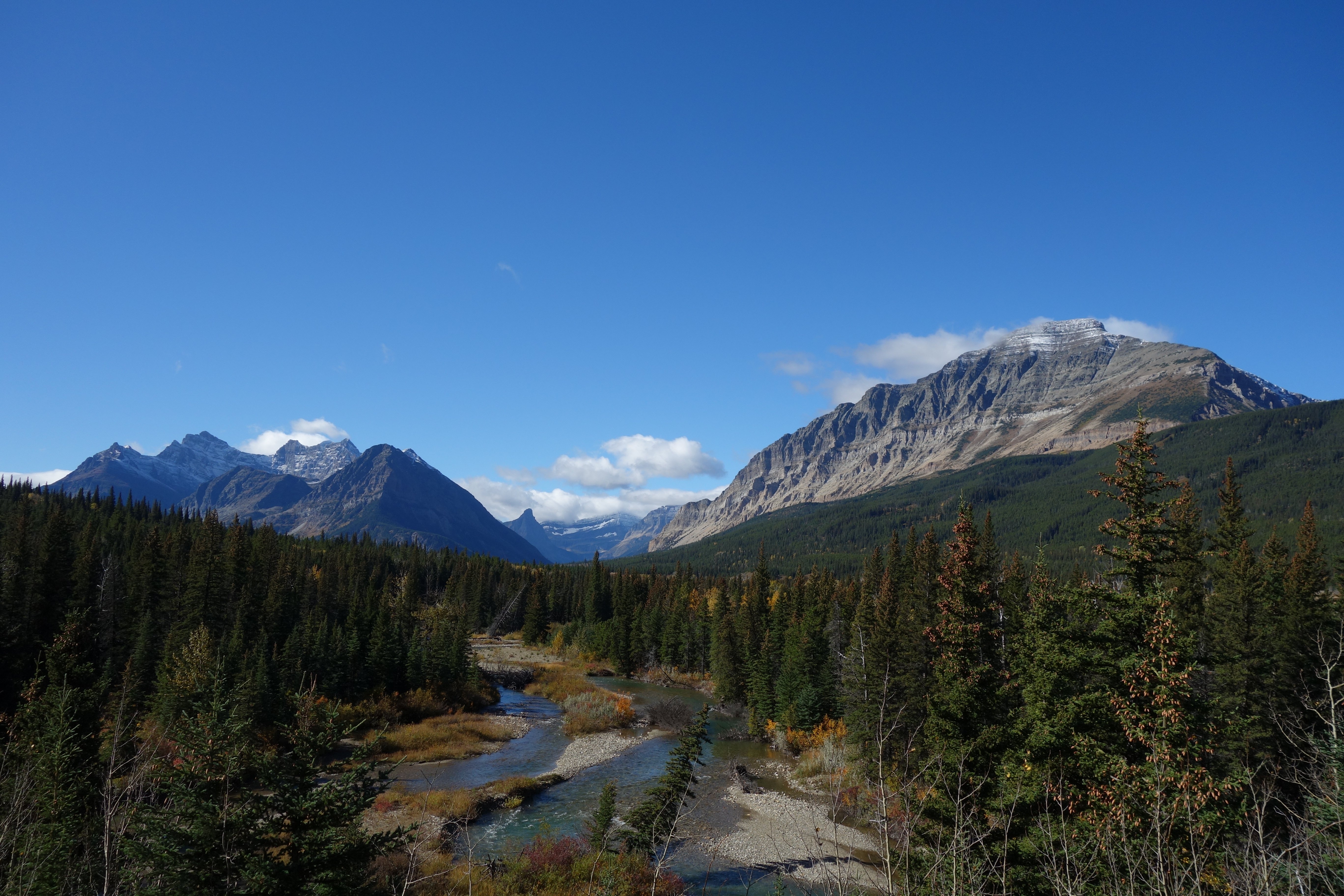
The hike across the park started off gentle without much elevation gain. This combined with blue skies during the morning made for an idyllic first day. Not by choice, I took it slow as equestrian traffic had muddied up the trail and made it a slippery situation. Once at the Belly River, I was met with a disassembled bridge. It seemed like the park service had removed it for the season. Quite amusing. Without skipping a beat, I turned around and took the horse crossing across the shallow end of the river. Already, it looked like wet shoes were a foregone conclusion.
As I made my way into the valley, I was surrounded by towering peaks of sedimentary rocks already dusted with a light layer of snow. I kept following the trail as it went from one pristine lake to another until it reached the end of the first valley. The first climb began.
The hike up Stoney Indian Pass at 6,908 feet had excellent tread and was over before I knew it. By the time I reached the top, clouds had already darkened the surrounding mountains. Darn! The views of Glacier up high are always a 100 times more gorgeous under sunny skies. But, hey, at least it wasn’t raining. I continued on.
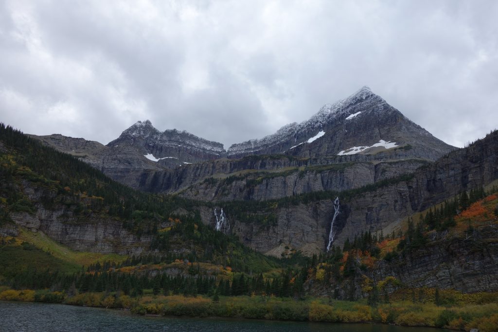
The next day had a climb up Brown Pass. In typical Glacier fashion, the hike up was more of the same jaw-dropping views! The walk through the valley was a showcase of one masterpiece after another. The mountains, built from layers upon layers of rocks, tell of a history I don’t know much about. I simply took the time to marvel at the artwork millions of years in the making. At the upper basin of the valley is Thunderbird Pond. It’s encapsulated by sheer cliffs with glaciers and waterfalls all around. I shook my head in disbelief at such a stunning landscape. This was a special place.
The hike down from Brown Pass to the last valley revealed a shimmering lake that stretched as far as my eyes could see. Bowman Lake. The trail follows it for its entirety of seven miles.
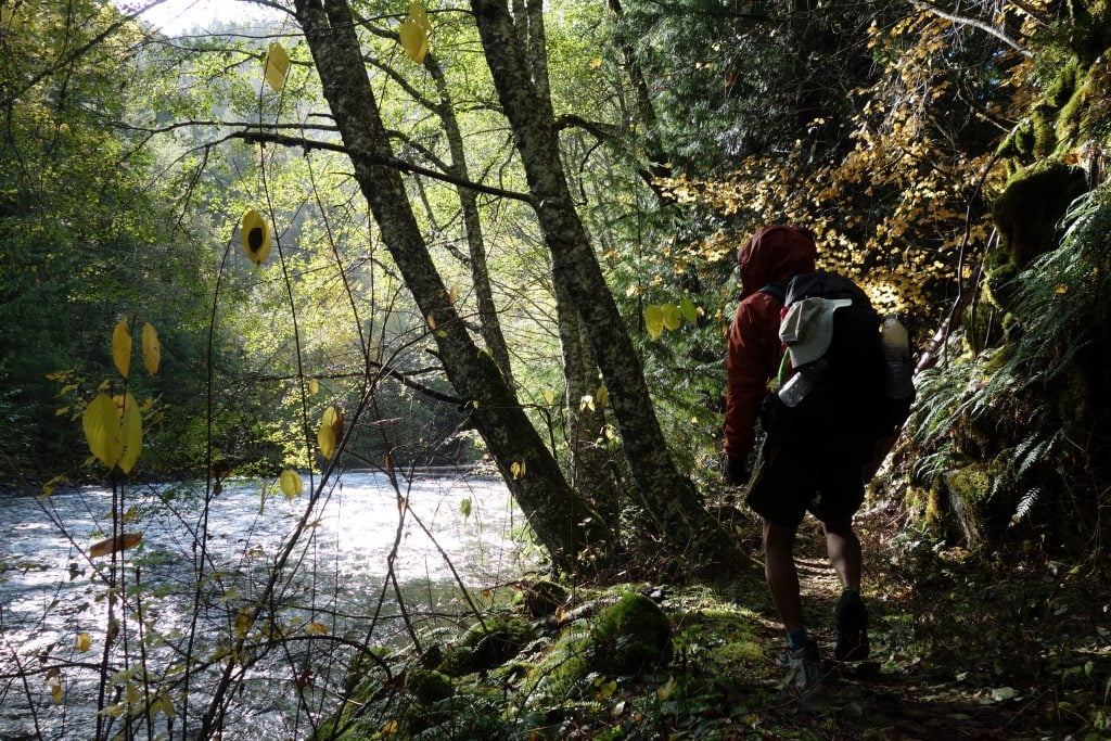
And just like that, the PNT through Glacier was over. The small town of Polebridge marks the end of the park. The trail then transitions into a more forested landscape for a time.
Venturing Down the Snowy Rabbit Hole
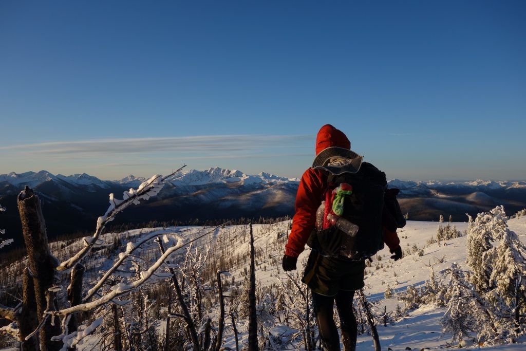
It was mid-October by the time I arrived in Oroville, WA. This rural town is the staging ground before entering the Pasayten Wilderness—the most remote section of the PNT. It’s about 160 miles with no easy bailout points until the next resupply. It’s also a no man’s land this time of year. The Pasayten had already transformed into a winter wonderland of nearly complete snow.
I had reached the crux of the PNT.
The trail enters the Pasayten from the east via a maze of jeep roads. It seemed like an uninteresting area where you wouldn’t expect much traffic, but hunting season had just begun, so hordes of trucks were roaming the area. Not until I got off the road and on actual trail did the feeling of isolation set in. The undisturbed layer of snow confirmed what I already knew. I was completely alone. No other footprints besides animal tracks existed. I continued diving deeper into the Pasayten.
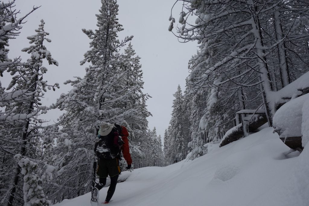
With the landscape blanketed in snow, navigation became increasingly difficult. In certain locations, namely flat and open areas, no signs of the trail could be had. No bare ground. No markers. No depressions. Just snow everywhere. I had to constantly check my maps to verify I was hiking in the right direction every time the trail disappeared. However, for the most part, the trail could still be followed beneath all the snow.
After a week of breaking snow, I was stoked about finally reaching familiar territory where the Pacific Crest Trail (PCT) coexists with the PNT for 14 miles just before the Canadian border. The PCT is one of my favorite trails, and a trail I have much sentimental attachment to. I was eager to make my first return.
Once I got closer to Frosty Pass, where on the other side the PCT awaited, I saw something I hadn’t seen since entering the Pasayten. Human footprints! I immediately knew who they belonged to—PCT thru-hikers!
But something was off. There were too many sets. I started to get a sick feeling in my stomach the more I thought about it because I knew a certain fact: thru-hikers don’t do alternates that add miles this late in the season. Not this close to the end. And definitely not under snowfall. It just doesn’t happen. Unless they were forced to because of something on the official route.
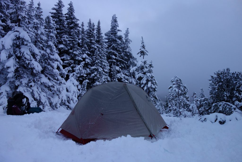
I reached the PNT/PCT junction that night and camped on the trail. As I prepared for the next day, I studied my maps to try to figure out why so many PCT thru-hikers were taking an alternate to reach Canada. I could see that the official PCT does a ridge run that goes over 7,000 feet for a short period of time. Could the snow level be that bad on the next section? I had camped at 7,000 feet the previous night on the summit of Bunker Hill, and the snow there was quite manageable. I decided to stop worrying and get some sleep. I’ll deal with it tomorrow.
As I slept, the worst snowstorm I experienced during my entire hike swept in.
The Eye of the Pasayten
I woke up the next morning with my tent buried under a half foot of new snow. It was the wet and heavy kind. And it continued to come down. Unfortunately, I had no choice but to hike. I was two days behind schedule and didn’t have enough food to consider zeroing.
As the trail climbed higher, the snow started to get deeper. A lot deeper than any previous section of the Pasayten. Soon I was wading in snow up to my thighs. Every single step was a struggle. The wind and snow continued to wallop me at irregular intervals. My eyeglasses kept fogging up, which made navigation frustrating. I really needed to off the exposed ridge.
When I finally got to lower elevation along the slope, the postholing became more tolerable. I put my head down and continued slogging. Then all of a sudden I heard a “hello!” My head snapped up in bewilderment. Approaching me in the distance was a group of five PCT thru-hikers. I couldn’t tell who was more surprised to find the other ones out here. I was meeting some of the last PCT thru-hikers to finish for 2016. After talking trail for a while and sharing beta, we all wished each other a safe journey and continued our separate ways.
I thought I was in luck to be able to follow their postholes for the rest of the day, but upon arriving at their camping spot, I discovered their tracks beyond that point ceased to exist. The snow had already erased any signs of their postholes. I was back to breaking snow again.
From the beta that was shared with me, the 2.5-mile section between Woody Pass and Rock Pass presented uncertain conditions. After cresting over the first pass and peering into the continuing snowstorm, the northwest slope of Powder Mtn. revealed itself littered in avalanche debris. I needed to get through this section as quickly and safety as possible. I dropped down and crossed the slope at its least steepest before starting my climb up to the second pass.
The snow got incredibly deep again near the pass even though I remained below 6,500 feet. After reaching the top, I was completely exhausted, and night was approaching. The trail had disappeared, but it was supposed to remain at high elevation before dropping into the valley. I opted for the more sensible option. I shot straight down to Canyon Creek 1,000 feet below and called it a day. I planned to find the trail the next day. I had walked all day and only managed ten miles, but I was satisfied. I survived the toughest stretch of the Pasayten.
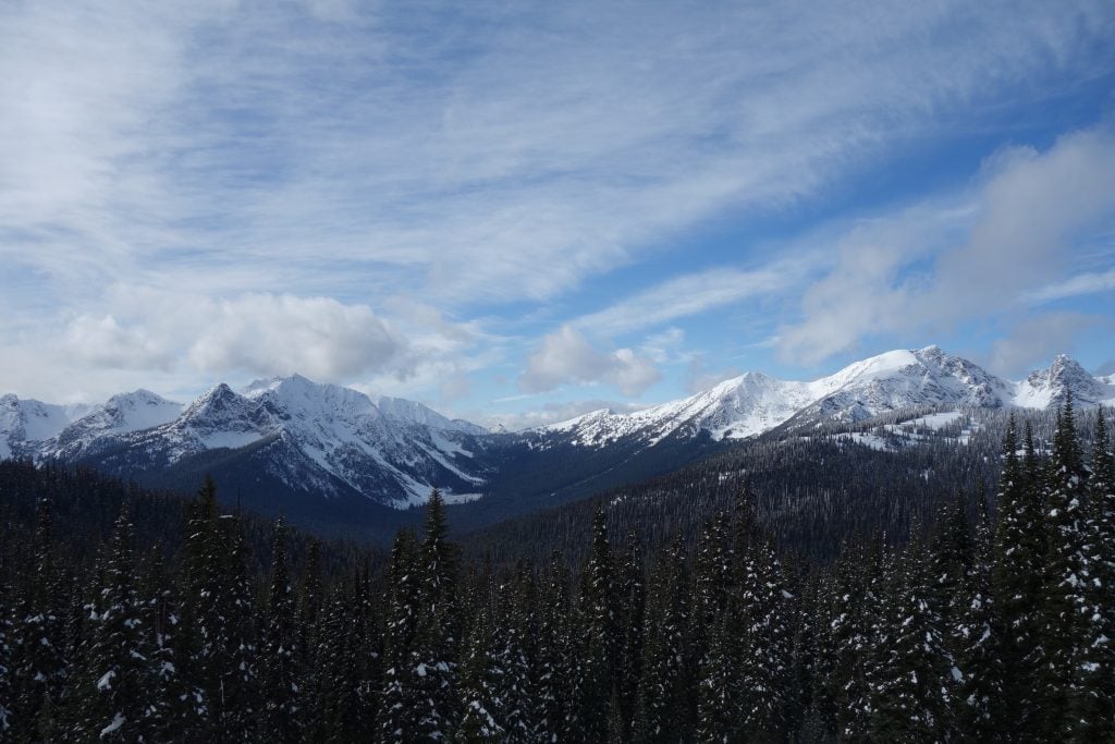
Two days later I safely arrived at Ross Lake with only a half bag of cookies left for food. I was pretty eager to hitch to Winthrop for a hot meal and to resupply. The trail was mostly snow-free going forward except for the high passes. However, snow was replaced by freezing rain. And it rained nearly every day until the end.
Rugged Beach Life
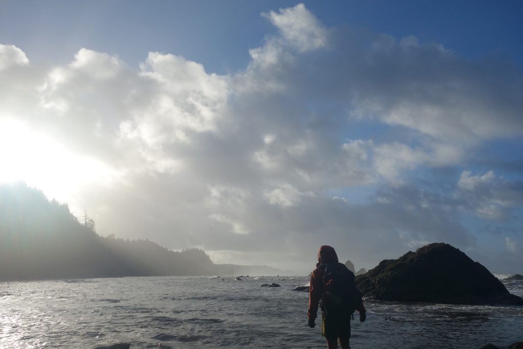
Upon reaching the Wilderness Coast within Olympic National Park, the final stretch of the PNT, additional challenges surfaced on the beach. As a Coloradan, I feel more comfortable in the mountains, covered in snow or not, than around the ocean. The unbroken sound of crashing waves kept reminding me of its destructive power. And the water was never too far because high tide was right in the middle of already short days. Every day I was forced to take overland routes and wait out high tide at certain crossings.
Mosquito Creek was one of those problematic crossings. It’s a crossing on the beach where if you get swept, you’ll likely get carried into the ocean. It was high tide when I got there. The water was murky, so I picked up a big stick to gauge its depth. I stepped into the water and hit ground. My second step also hit ground. On the third step I was treading water. It was definitely a no go at the moment, so I got out and waited. After a few hours of watching the tide recede, I threw a buoy in the creek to assess the current. It didn’t drift away like the first one I threw in. It was now possible to cross.
I had grown a bit apprehensive after doing so many tough fords in Washington that I decided to take additional precautions for this crossing. I went around the beach and collected small buoys and strapped them to my pack (I can’t swim very well). I also picked up the big stick I had before and went for it. As confirmed, the current was motionless, but the water was still deep. My pack kept my head above water as I doggy paddled across the creek until I hit land. I sighed in relief as I stumbled out of the water.
Triumph at the Cape!
After several days of beach hiking, I only had 12 miles left until the end. I woke up to a rare sunny day and knew I had to finish today. But by 9:30 a.m. and only three miles in, high tide had me stopped on a rock. The beach had vanished, and there was nothing but cliffs ahead. Not until 2 p.m. did the ocean begin to open up. The end was actually going to happen! And I had to finish today.
But night arrived, and I didn’t make it. 12 miles was simply too much. I decided to break one of my rules and night hiked for miles. I was too close to the end to be denied. I eventually got there.
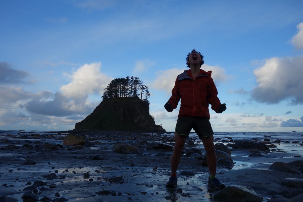
Cape Alava!! The western terminus of the Pacific Northwest Trail.
I took in the amazing scenery the next morning. It was another glorious, sunny day. Just unbelievable!
5 Tips for Thru-hiking the Pacific Northwest Trail
- Choose your own adventure
The PNT is a young trail and is not very well signed compared to other long-distance trails such as the Appalachian Trail or Pacific Crest Trail. As a result, this encourages hikers to explore and to not feel beholden to the official route.
Make the PNT your own unique adventure by considering the alternates or following your own route if you see something interesting on the map.
- Have your rain system ready
The Pacific Northwest can be a very wet region. Before starting the PNT, make sure to have your rain system dialed in so you stay comfortable hiking and camping in rain and you keep your gear dry.
- Be prepared for flooded rivers and creeks
If it rains a lot during your hike, especially in Washington, you may encounter flooded rivers and creeks. Be ready to find another route forward or wait until water levels fall and become safe for crossing.
At Swift Creek, south of Mt. Baker in Washington, I had to wait two nights before the flooded creek became passable.
- Review the permit restrictions
The PNT passes through three national parks: Glacier NP, North Cascades NP, and Olympic NP. Thru-hikers need to be aware of the specific restrictions regarding camping and food storage in these areas.
Glacier NP will be the most difficult park to obtain backcountry camping permits during peak season so plan accordingly. Also, Olympic NP currently requires a bear canister along the entire Wilderness Coast and certain popular locations.
- Visit the PNTA official site
The Pacific Northwest Trail Association is an excellent resource for prospective PNT thru-hikers. Its website should be the first place you visit if you are contemplating a thru-hike. Another great resource is the PNT Facebook page, currently the most popular place for past, current and future PNT thru-hikers to share information.
Quoc Nguyen, a.k.a. Double Magic, was born in Vietnam and now hails from Littleton, Colorado. He has a BSBA from the University of Colorado Denver and a JD from the University of Denver. His life is mostly hiking—whether that’s for peak bagging or thru-hiking. The Colorado mountains are his beloved playground and he’s currently chasing his dream to climb all the 13ers. Last summer, he completed the last of his Triple Crown of thru-hiking, the CTD.